Aerial views, from satellites or conventional aircraft, already provide a wealth of information. Machine vision can maximise the potential of these images, helping in the assessment of environmental change, enabling more efficient land use and providing geological infromation.
Height information from pairs of aerial photographs is conventionally
obtained manually using stereoscopic viewers. This approach is limited
in its accuracy, and is time-consuming. Machine vision techniques can be
used to automatically interpret the slight differences between images
taken from different perspectives. For instances, if two points,
adjacent in one image, are at the same height as one another, they will
be adjacent in the second image. However, if their heights differ, they
will be separated in the second image. This disparity between image
points and further information, such as speed and altitude of the
aircraft, yields depth data. A 3D model, with absolute height
information, can be constructed, and compared with a 3D model obtained
from a contour map, thus providing information on crop or tree height,
or geographical changes.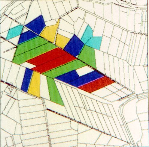 Remote sensing can provide data on agricultural activities in
inaccessible areas, or simply obtain more accurate information than
otherwise available. This information can be obtained from radar images,
and interpreted using machine vision techniques to identify different
agricultural regions or crop types. The back-scatter signature from each
crop varies according to its characteristics, such as leaf moisture,
plant separation and number of leaves per square metre. Crop growth
models predict the characteristics of different crops at given times,
and provide inputs to radar models which estimate the back-scatter from
each crop of interest. These predictions are used to interpret the image
measurements. Techniques to provide robustness to calibration and
unknown environmental factors are included at this stage. Such a system
is found to be about 75% successful in identifying five different crop
types.
Remote sensing can provide data on agricultural activities in
inaccessible areas, or simply obtain more accurate information than
otherwise available. This information can be obtained from radar images,
and interpreted using machine vision techniques to identify different
agricultural regions or crop types. The back-scatter signature from each
crop varies according to its characteristics, such as leaf moisture,
plant separation and number of leaves per square metre. Crop growth
models predict the characteristics of different crops at given times,
and provide inputs to radar models which estimate the back-scatter from
each crop of interest. These predictions are used to interpret the image
measurements. Techniques to provide robustness to calibration and
unknown environmental factors are included at this stage. Such a system
is found to be about 75% successful in identifying five different crop
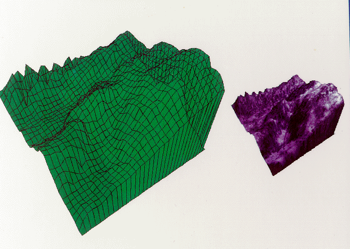
types.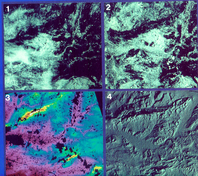 Satellite images are a valuable source of information. Machine vision
techniques can be used to produce 3D models of the earth's surface,
yielding data useful for geological, geographical and environmental
applications. 3D models can be produced from pairs of images taken from
different angles (Fig 1 and Fig 2). As the images are acquired by the
SPOT satellite at different times, the quality of the two images may
vary. For example, features such as clouds and jet contrails may appear
on one image and not on the other. When producing a digital elevation
model (DEM), these atmospheric features are excluded (Fig 3). Data from
subsequent images can be used to fill these areas. By merging data in
this way, greater accuracy can be achieved. The completed DEM can be
displayed as a shaded image (Fig 4) or as a full colour video animation.
Satellite images are a valuable source of information. Machine vision
techniques can be used to produce 3D models of the earth's surface,
yielding data useful for geological, geographical and environmental
applications. 3D models can be produced from pairs of images taken from
different angles (Fig 1 and Fig 2). As the images are acquired by the
SPOT satellite at different times, the quality of the two images may
vary. For example, features such as clouds and jet contrails may appear
on one image and not on the other. When producing a digital elevation
model (DEM), these atmospheric features are excluded (Fig 3). Data from
subsequent images can be used to fill these areas. By merging data in
this way, greater accuracy can be achieved. The completed DEM can be
displayed as a shaded image (Fig 4) or as a full colour video animation.